Home > Europe > United Kingdom > Maps
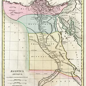
1809, Pinkerton Map of Southern Africa, John Pinkerton, 1758 - 1826, Scottish antiquarian

![]()
Wall Art and Photo Gifts from Liszt Collection
1809, Pinkerton Map of Southern Africa, John Pinkerton, 1758 - 1826, Scottish antiquarian
1809, Pinkerton Map of Southern Africa, John Pinkerton, 1758 - 1826, Scottish antiquarian, cartographer, UK
Liszt Collection of nineteenth-century engravings and images to browse and enjoy
Media ID 14006976
© Artokoloro Quint Lox Limited
1758 1826 1758 – 1826 17581826 1809 Cartographer John Pinkerton Scottish Antiquarian Antique Map Atlas Chart Geographic Latitude Longitude Mappa Mundi Old Antique Plan Old Antique View Old Map Ols Antique Map Rare Old Maps Topo
FEATURES IN THESE COLLECTIONS
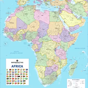
> Africa
> Related Images
> Europe
> United Kingdom
> Maps
> Maps and Charts
> Early Maps
> Maps and Charts
> World
EDITORS COMMENTS
This print showcases the remarkable "1809, Pinkerton Map of Southern Africa" created by John Pinkerton, a renowned Scottish antiquarian and cartographer. With an illustrious career spanning from 1758 to 1826, Pinkerton's expertise in topography and geography is evident in this vintage map. The intricately detailed illustration depicts the diverse landscapes and geographical features of Southern Africa. From its majestic mountain ranges to its sprawling plains, every contour is meticulously captured on this historic piece of paper. The chart's grid system allows for precise navigation through latitude and longitude coordinates, revealing Pinkerton's dedication to accuracy. As we delve into the past through this ancient artifact, we are transported back in time to an era of exploration and discovery. This rare old map serves as a window into history, offering insights into how early cartographers perceived the world. Adorned with decorative elements that add charm and character, this antique map holds both artistic value and historical significance. Its aged appearance adds a sense of authenticity that further enhances its allure. Whether you are a history enthusiast or simply appreciate the beauty of vintage artistry, this stunning print will undoubtedly captivate your imagination. It invites us to embark on a journey through time while celebrating the incredible legacy left behind by John Pinkerton – an extraordinary figure who shaped our understanding of geography forever.
MADE IN THE USA
Safe Shipping with 30 Day Money Back Guarantee
FREE PERSONALISATION*
We are proud to offer a range of customisation features including Personalised Captions, Color Filters and Picture Zoom Tools
SECURE PAYMENTS
We happily accept a wide range of payment options so you can pay for the things you need in the way that is most convenient for you
* Options may vary by product and licensing agreement. Zoomed Pictures can be adjusted in the Cart.