Home > Maps and Charts > World
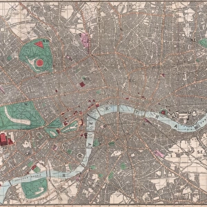
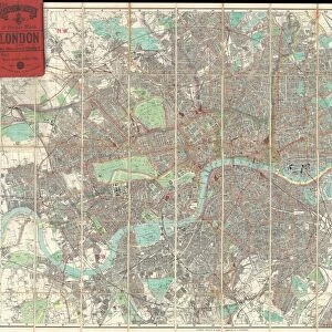
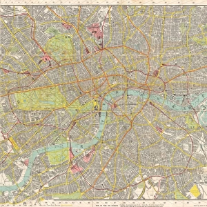
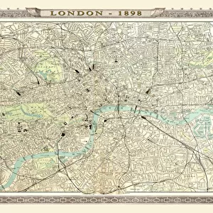
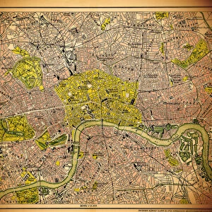
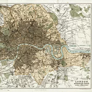
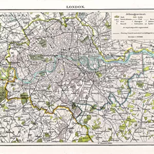
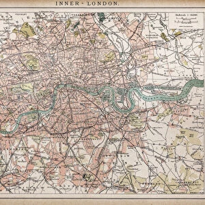
1899, Bacon Pocket Plan or Map of London, topography, cartography, geography, land

![]()
Wall Art and Photo Gifts from Liszt Collection
1899, Bacon Pocket Plan or Map of London, topography, cartography, geography, land
1899, Bacon Pocket Plan or Map of London
Liszt Collection of nineteenth-century engravings and images to browse and enjoy
Media ID 14008141
© Artokoloro Quint Lox Limited
1899 Antique Map Atlas Chart Geographic Latitude Longitude Mappa Mundi Old Antique Plan Old Antique View Old Map Ols Antique Map Rare Old Maps Topo
FEATURES IN THESE COLLECTIONS
> Europe
> United Kingdom
> England
> London
> Related Images
> Maps and Charts
> Early Maps
> Maps and Charts
> World
EDITORS COMMENTS
This print showcases the remarkable "1899, Bacon Pocket Plan or Map of London". Immerse yourself in a journey through time as you explore this exquisite piece of topography, cartography, and geography. The intricate details displayed on this vintage map transport you to an era long gone by. Every line and contour on this ancient paper serves as a testament to the artistry and precision that went into its creation. With its decorative elements and historical significance, it is more than just a mere map; it is a window into the past. As your eyes wander across the delicate grid lines denoting latitude and longitude, you can't help but marvel at how such an intricate web of information was meticulously crafted without modern technology. This rare old map holds within it not only geographical knowledge but also whispers of countless journeys taken by those who relied on its guidance. The faded colors evoke a sense of nostalgia while reminding us that history continues to shape our present reality. Whether you are an avid traveler or simply fascinated by the world's wonders, this antique treasure will undoubtedly ignite your curiosity for exploration. Let this extraordinary print from Liszt Collection transport you back in time as you uncover London's rich heritage through the lens of cartographic excellence.
MADE IN THE USA
Safe Shipping with 30 Day Money Back Guarantee
FREE PERSONALISATION*
We are proud to offer a range of customisation features including Personalised Captions, Color Filters and Picture Zoom Tools
SECURE PAYMENTS
We happily accept a wide range of payment options so you can pay for the things you need in the way that is most convenient for you
* Options may vary by product and licensing agreement. Zoomed Pictures can be adjusted in the Cart.