Home > North America > United States of America > New York > New York > Maps
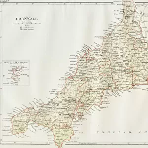
1910, U. S. Coast Survey Nautical Chart or Map of New York City and Harbor, topography

![]()
Wall Art and Photo Gifts from Liszt Collection
1910, U. S. Coast Survey Nautical Chart or Map of New York City and Harbor, topography
1910, U.S. Coast Survey Nautical Chart or Map of New York City and Harbor
Liszt Collection of nineteenth-century engravings and images to browse and enjoy
Media ID 14008139
© Artokoloro Quint Lox Limited
1910 Antique Map Atlas Chart Geographic Latitude Longitude Mappa Mundi Old Antique Plan Old Antique View Old Map Ols Antique Map Rare Old Maps Topo
FEATURES IN THESE COLLECTIONS
> Maps and Charts
> Early Maps
> Maps and Charts
> World
> North America
> United States of America
> New York
> New York
> Maps
EDITORS COMMENTS
This vintage print showcases the intricate details of a 1910 U. S. Coast Survey Nautical Chart or Map of New York City and Harbor. With its topographical features, this map provides a fascinating glimpse into the geography and cartography of one of America's most iconic cities. The illustration captures the land formations, grid patterns, latitude and longitude lines, as well as other geometric elements that were crucial for navigation during that era. The aged paper adds to the charm and historical significance of this artwork, evoking a sense of nostalgia for a bygone era. It serves as a reminder of how maps were once meticulously crafted by hand to aid in exploration and discovery. As we gaze upon this decorative piece, we are transported back in time to an age when travel was more arduous but filled with excitement and wonder. This rare old map offers us a window into history, allowing us to imagine what life was like in early 20th century New York City. Whether you are an avid collector or simply appreciate art with historical value, this antique map from the Liszt Collection is sure to captivate your imagination and spark conversations about our ever-changing world throughout time.
MADE IN THE USA
Safe Shipping with 30 Day Money Back Guarantee
FREE PERSONALISATION*
We are proud to offer a range of customisation features including Personalised Captions, Color Filters and Picture Zoom Tools
SECURE PAYMENTS
We happily accept a wide range of payment options so you can pay for the things you need in the way that is most convenient for you
* Options may vary by product and licensing agreement. Zoomed Pictures can be adjusted in the Cart.