Home > Asia > Iraq > Maps
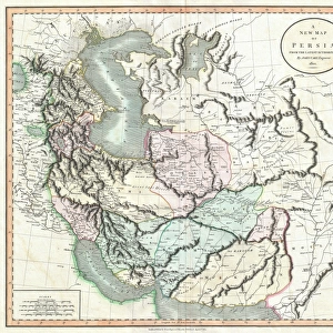
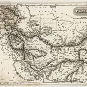
1771, Bonne Map of Persia, Iran, Iraq, Afghanistan, Rigobert Bonne 1727 - 1794

![]()
Wall Art and Photo Gifts from Liszt Collection
1771, Bonne Map of Persia, Iran, Iraq, Afghanistan, Rigobert Bonne 1727 - 1794
1771, Bonne Map of Persia, Iran, Iraq, Afghanistan, Rigobert Bonne 1727 - 1794, one of the most important cartographers of the late 18th century
Liszt Collection of nineteenth-century engravings and images to browse and enjoy
Media ID 14004699
© Artokoloro Quint Lox Limited
1771 Afghanistan Iran Iraq Rigobert Bonne 1727 1794 Rigobert Bonne 1727 – 1794 Rigobert Bonne 17271794 Antique Map Atlas Chart Geographic Latitude Longitude Mappa Mundi Old Antique Plan Old Antique View Old Map Ols Antique Map Rare Old Maps Topo
FEATURES IN THESE COLLECTIONS
> Asia
> Afghanistan
> Maps
> Maps and Charts
> Early Maps
> Maps and Charts
> World
EDITORS COMMENTS
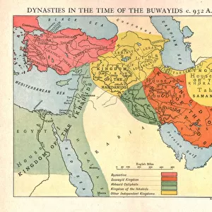
This vintage print showcases the remarkable 1771 Bonne Map of Persia, Iran, Iraq, and Afghanistan by Rigobert Bonne. As one of the most influential cartographers during the late 18th century, Bonne's expertise in topography and geography is evident in this intricate illustration. The map provides a detailed depiction of the region's landscape, offering a valuable resource for travelers and explorers alike. With its carefully marked grid lines indicating latitude and longitude, this antique map serves as an essential tool for navigation. Its geometric precision captures the essence of cartographic artistry from centuries past. The aged appearance adds to its historical charm, making it a captivating piece that transports viewers back in time. The Bonne Map not only offers insight into ancient history but also highlights significant regions within Persia (modern-day Iran), Iraq, Afghanistan, and beyond. It represents a mappa mundi—a visual representation of our world—providing invaluable knowledge about different spaces and regions during that era. This rare old map holds immense historical value as it reflects the exploration and discovery prevalent at that time. A true testament to Rigobert Bonne's skillful craftsmanship, this decorative print is sure to captivate any admirer of antique maps or those with an appreciation for Earth's rich geographical heritage.
MADE IN THE USA
Safe Shipping with 30 Day Money Back Guarantee
FREE PERSONALISATION*
We are proud to offer a range of customisation features including Personalised Captions, Color Filters and Picture Zoom Tools
SECURE PAYMENTS
We happily accept a wide range of payment options so you can pay for the things you need in the way that is most convenient for you
* Options may vary by product and licensing agreement. Zoomed Pictures can be adjusted in the Cart.