Home > Europe > United Kingdom > Scotland > Edinburgh > Edinburgh
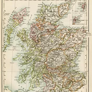
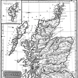
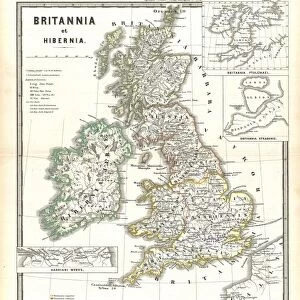
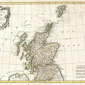
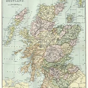
1815, Thomson Map of Southern Scotland, John Thomson, 1777 - 1840, was a Scottish

![]()
Wall Art and Photo Gifts from Liszt Collection
1815, Thomson Map of Southern Scotland, John Thomson, 1777 - 1840, was a Scottish
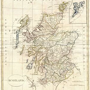
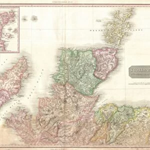
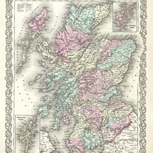
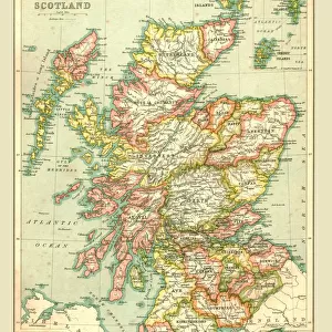
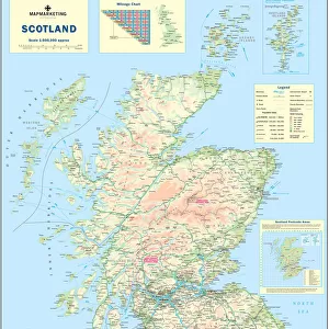
1815, Thomson Map of Southern Scotland, John Thomson, 1777 - 1840, was a Scottish cartographer from Edinburgh, UK
Liszt Collection of nineteenth-century engravings and images to browse and enjoy
Media ID 14006999
© Artokoloro Quint Lox Limited
1777 1840 1815 John Thomson Antique Map Atlas Chart Geographic Latitude Longitude Mappa Mundi Old Antique Plan Old Antique View Old Map Ols Antique Map Rare Old Maps Topo
FEATURES IN THESE COLLECTIONS
> Arts
> Artists
> T
> John Thomson
> Europe
> United Kingdom
> Maps
> Europe
> United Kingdom
> Scotland
> Edinburgh
> Edinburgh
> Europe
> United Kingdom
> Scotland
> Edinburgh
> Europe
> United Kingdom
> Scotland
> Lothian
> Edinburgh
> Europe
> United Kingdom
> Scotland
> Maps
> Maps and Charts
> Early Maps
> Maps and Charts
> World
EDITORS COMMENTS
This print showcases the exquisite 1815 Thomson Map of Southern Scotland, meticulously crafted by the talented Scottish cartographer, John Thomson. Born in Edinburgh in 1777 and passing away in 1840, Thomson left an indelible mark on the world of cartography. The map itself is a true work of art, displaying intricate details and topographical features that transport us back to a bygone era. Its carefully drawn lines depict latitude and longitude grids, offering a comprehensive understanding of the region's geography. As we gaze upon this vintage piece, we are reminded of its historical significance and its role in aiding navigation during times when technology was far from advanced. The aged appearance adds an air of authenticity to this rare old map, evoking a sense of discovery and exploration. With its decorative elements and artistic flair, this ancient relic serves as both an educational tool for geographic enthusiasts and a stunning display for history buffs. It allows us to delve into the past while appreciating the craftsmanship involved in creating such detailed representations. Whether used as an educational resource or admired purely for its aesthetic appeal, this remarkable print from Liszt Collection takes us on a journey through time – reminding us how maps have shaped our understanding of our world throughout history.
MADE IN THE USA
Safe Shipping with 30 Day Money Back Guarantee
FREE PERSONALISATION*
We are proud to offer a range of customisation features including Personalised Captions, Color Filters and Picture Zoom Tools
SECURE PAYMENTS
We happily accept a wide range of payment options so you can pay for the things you need in the way that is most convenient for you
* Options may vary by product and licensing agreement. Zoomed Pictures can be adjusted in the Cart.