
Wall Art and Photo Gifts from Fine Art Storehouse
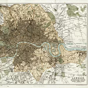
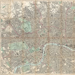
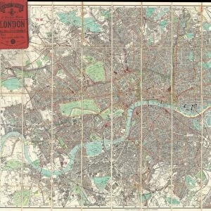
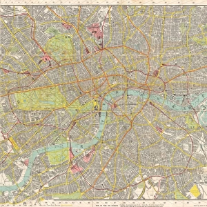
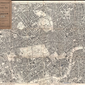
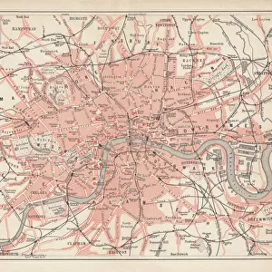
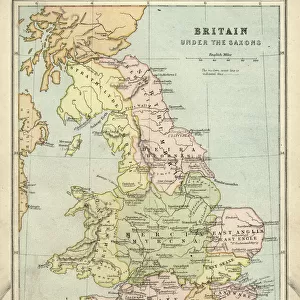
Historic map of London (18th Century)
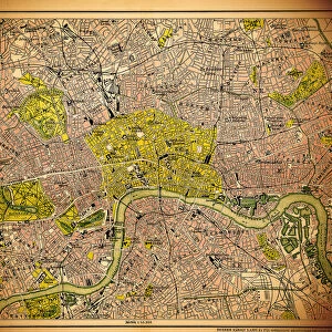
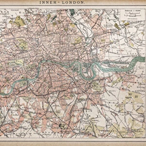
map/plan of the inner city of London from 1899
Unleash your creativity and transform your space into a visual masterpiece!
Nastasic
Media ID 19860027
© Nikola Nastasic
Vignette
Retro Styled
FEATURES IN THESE COLLECTIONS
> Europe
> United Kingdom
> England
> London
> Boroughs
> City of London
> Fine Art Storehouse
> Map
> Historical Maps
> Fine Art Storehouse
> Map
> Maps and Charts
> Early Maps
MADE IN THE USA
Safe Shipping with 30 Day Money Back Guarantee
FREE PERSONALISATION*
We are proud to offer a range of customisation features including Personalised Captions, Color Filters and Picture Zoom Tools
SECURE PAYMENTS
We happily accept a wide range of payment options so you can pay for the things you need in the way that is most convenient for you
* Options may vary by product and licensing agreement. Zoomed Pictures can be adjusted in the Cart.
redeem
Beautiful Photo Prints and Gifts
image
Professionally Printed
inventory
Photo Prints are in stock
thumb_up
Professional quality finish
diamond
Made with high-grade materials
inventory_2
Carefully packed to aid safe arrival
Related Images
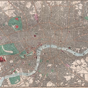
Historic map of London
MAP / LONDON 1878
Antquie Map of London, 1895
1862, Reynolds Pocket Map of London, England, topography, cartography, geography
1890, Bacon Travelers Pocket Map of London, England, topography, cartography
1895, Philip Pocket Map or Plan of London, England, topography, cartography, geography
1910, Smiths Tape Indicator, Map of London, Pocket Map, topography, cartography
1899, Bacon Pocket Plan or Map of London, topography, cartography, geography, land
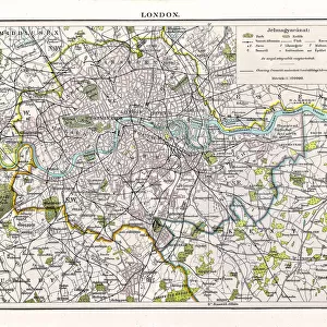
Historic map of London (18th Century)
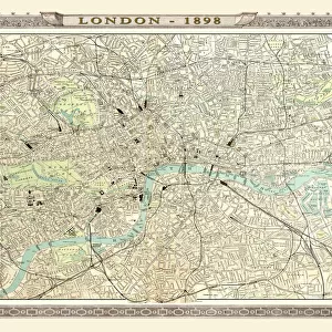
Old Map of London 1898 from the Royal Atlas by Bartholomew
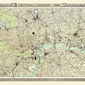
Old Map of Central London 1898 from the Royal Atlas by Bartholomew
City map of London, lithograph, lithograph, published in 1877
Related Collections

Early Maps
Browse 24,907 Prints
Map
Browse 9,856 Prints
City of London
Browse 14,231 Prints
Historical Maps
Browse 3,307 Prints

")