Home > Europe > France > Canton > Loire
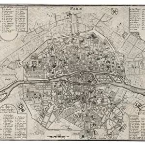
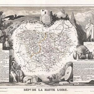
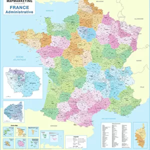
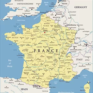
1852, Levasseur Map of the Department De Maine et Loire, France, topography, cartography

![]()
Wall Art and Photo Gifts from Liszt Collection
1852, Levasseur Map of the Department De Maine et Loire, France, topography, cartography
1852, Levasseur Map of the Department De Maine et Loire, France
Liszt Collection of nineteenth-century engravings and images to browse and enjoy
Media ID 14005291
© Artokoloro Quint Lox Limited
1852 Antique Map Atlas Chart Geographic Latitude Longitude Mappa Mundi Old Antique Plan Old Antique View Old Map Ols Antique Map Rare Old Maps Topo
FEATURES IN THESE COLLECTIONS
> Europe
> France
> Canton
> Loire
> Europe
> France
> Canton
> Maine
> Maps and Charts
> Early Maps
> Maps and Charts
> World
EDITORS COMMENTS
This print showcases the exquisite 1852 Levasseur Map of the Department De Maine et Loire, France. A true masterpiece in topography and cartography, this vintage map offers a fascinating glimpse into the geography and land of this historic region. With its intricate illustration and precise geographic details, it serves as a remarkable tool for navigation and exploration. The aged paper exudes an aura of history, taking us back to a bygone era when maps were meticulously crafted by hand. Its decorative elements add an artistic touch to this historical artifact, making it not only informative but also visually appealing. As we delve into the past through this rare old map, we are transported on a journey of discovery. It reminds us of the importance placed on understanding our world's geography long before modern technology made it easily accessible. The latitude and longitude grid provides a sense of order amidst the vastness of Earth's landscapes. With its antique charm and rich historical significance, this Levasseur Map is more than just a piece of paper; it represents an invaluable link to our past. Whether you are an avid collector or simply appreciate artful relics from yesteryears, this print is sure to captivate your imagination with its timeless beauty.
MADE IN THE USA
Safe Shipping with 30 Day Money Back Guarantee
FREE PERSONALISATION*
We are proud to offer a range of customisation features including Personalised Captions, Color Filters and Picture Zoom Tools
SECURE PAYMENTS
We happily accept a wide range of payment options so you can pay for the things you need in the way that is most convenient for you
* Options may vary by product and licensing agreement. Zoomed Pictures can be adjusted in the Cart.